Sign up for the farmnewsNOW newsletter
Sunshine and warmer temperatures are need to melt snow in this northeast Saskatchewan field. (Alice McFarlane/farmnewsNOW Staff)
Spring Seeding Forecast

Meteorologist says spring weather still weeks away

Apr 13, 2020 | 5:36 PM

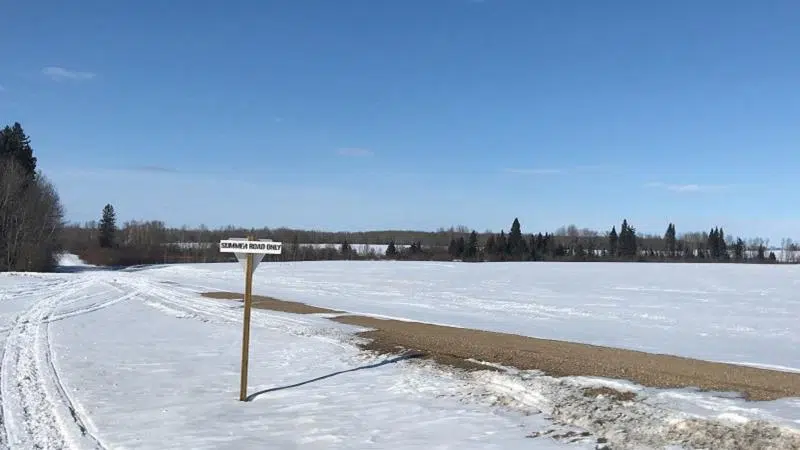
Farmers are waiting for the weather to warm up so they can pull the last pieces of equipment out of the snowbanks.

If they’re looking for a quick turnaround it’s not going to happen, according to World Weather meteorologist Drew Lerner.

“It’s a real challenge right now and I only can apologize for the situation we’re in right now,” Lerner told farmnewsNOW. “But there is hope. It’s spring and one of the things that always happens is the atmosphere does warm up. There is hope.”

There is a lot of snow that needs to melt in central and northern Saskatchewan. This is also the case in western Alberta and northern Manitoba as well. Lerner said the situation is not very appealing at the moment as farmers in the southern prairies would normally be in the field by now but there’s very little work of any kind taking place.

Lerner said this scenario is going to wind down as we go forward through the coming weeks.

“I think we’ve got a good opportunity to bring temperatures a lot closer to normal,” Lerner said. “It’ll actually come to normal in western parts of the prairies in Alberta, but for the eastern two thirds of the region we are going to have additional shots of cool air.

“They won’t be as potent as what we have dealt with here over the past week, and that’s good news. We will allow for temperatures to come close enough to normal that we will melt a little bit of snow from some areas. But the bottom line is shots of coolness will still continue to come and go periodically.”

Lerner said the good news is we will see a turnaround in a few weeks.

“As we move forward, the best news for most folks is there will be a period in the very last days of April, and the first 10 days in May when we should be able to warm up appreciably and probably get to the point where we can actually see the snow disappear in some areas and greatly reduced in others,” Lerner said.

Unfortunately the cooler weather pattern isn’t done with us yet.

“The sad thing, I think, is we will turn cooler again, a little later in May,” he said. “I do think that we are going to see this pattern resume again after a nice period of opportunity. We’ll have to kind of gauge it to see how long we can get the warmth. We want to be careful about those early season crops that are a little bit more vulnerable to frost and freezes because I’m not sure we’re done with those.”

Lerner said the biggest factors impacting our weather is the 18-year cycle and ocean temperatures in the Gulf of Alaska.

“This is a pattern repeated in the past I speak about quite often where we get the northwest flow,” he said. “The other factor is the Gulf of Alaska has been persistently warmer than normal for a very long period of time. There has been some change out there recently, which has been good and bad. A cooling trend and the ocean temperatures are back closer to normal there.

“But the western part of the gulf is still way above average on temperatures. What this is doing is it’s forcing the ridge of high pressure that has been giving us these cold shots. It’s giving you a chance to shift back to the west, which is making it colder periodically in Alberta and western Saskatchewan instead of Saskatchewan and Manitoba, which is more typical of the pattern we’ve been in.”

Lerner said the most interesting part is the rest of the northern hemisphere is not dealing with cold air. It’s all in Canada and has been for quite some time.

Looking to early summer, Lerner is optimistic there will be a more significant warming trend with precipitation.

“I do think we will finally warm up. That’s good news. I think there will be a shift in the distribution of rainfall across North America,” Lerner said. “Part of the problem with this northwest flow and all this cold air in Canada is it’s been raining consistently in the United States with big snow events down there as well.

“What’s going to happen is we warm up and we’re going to shift all the patterns to the north. What it will do is bring above average precipitation to portions of the southern prairies and also neighboring areas of the Northern U.S. plains.”

Lerner said when we get into the heart of summer, especially July and August, there will be a high frequency of rain occurring across the southern parts of the prairies. He said don’t read to much into it.

“I don’t want anybody to start worrying about getting so much rain that we can’t get into the fields or anything quite like that. But I do think we will have more abundant moisture and further recovery from the drought of the past few years. The drier bias in the prairies is probably going to be a little farther to the northwest, probably in the west central and northwest Saskatchewan and then bleeding over into parts of Alberta.”

Lerner said the Unity and Wilkie areas and west into Coronation and Hanna, Alta. will be areas that will not do as well with rainfall for the summer season. He said this won’t put them into an ongoing drought but rainfall in those areas will be much more limited in frequency and intensity.

“There will be a tendency for a little bit of moisture stress and certainly farmers stress about getting rainfall in some of those areas,” he said.

“This is more of a classic summer weather pattern where we always seem to have dryness in the interior western prairies and the tendency for precipitation to accrue more routinely in southern parts of Manitoba and southeastern Saskatchewan. I think that’s were we’re headed down the road.”

The Cervus Equipment John Deere Melfort World Weather report can be heard on 105CJVR weekdays at noon and on farmnewsNOW.com.

alice.mcfarlane@jpbg.ca

On Twitter: @AliceMcF

View Comments